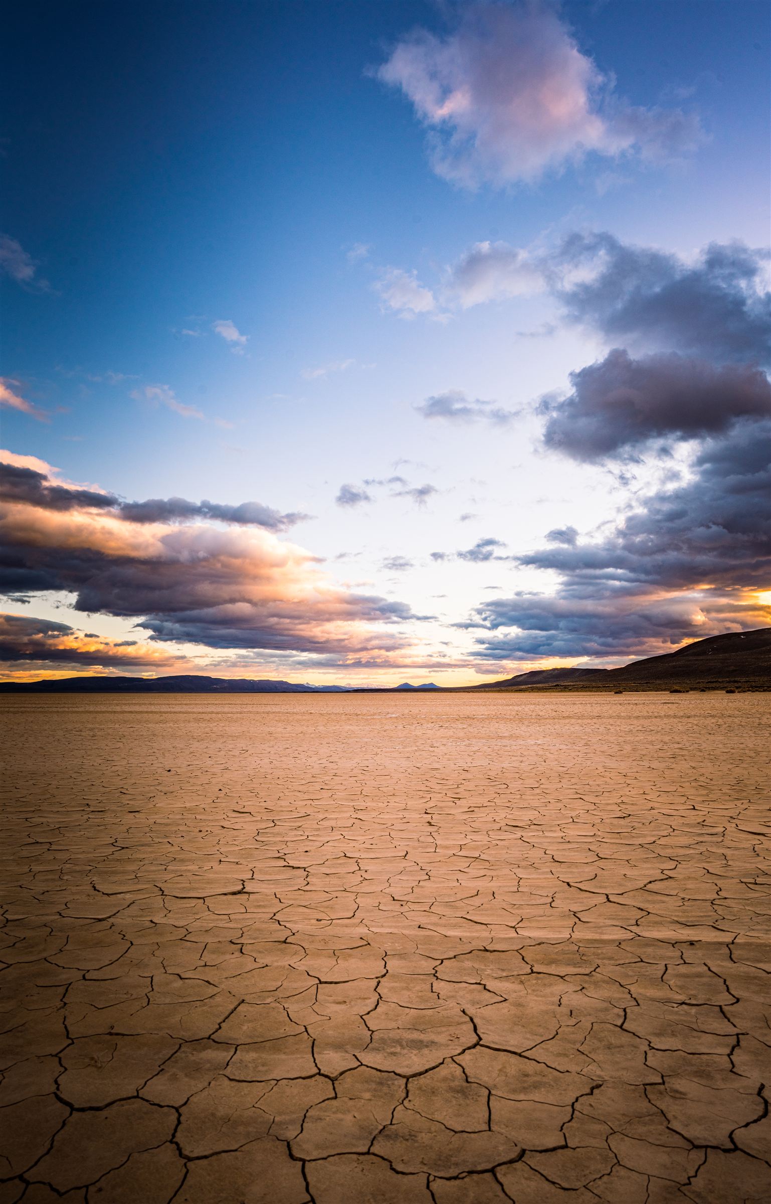
The complete guide to Oregon's most remote desert: miles of ancient lakebed, Bortle Class 1 skies, natural hot springs, and extreme isolation. Written by those who live here full-time.
Harney County, SE Oregon 42.5°N, 118.5°W
12 × 7 miles of playa One of Oregon's largest
Bortle Class 1-2 Among the darkest skies in the US
7" annual rainfall Oregon's driest location
Why the Alvord Desert is Unlike Anywhere Else
The Alvord Desert isn't just remote, it's profoundly isolated in a way that reshapes how you experience time, silence, and scale. Located in southeastern Oregon's high desert basin, this ancient lakebed stretches 12 miles long by 7 miles wide, among Oregon's largest playas, surrounded by the dramatic Steens Mountain to the west (rising to 9,733 feet) and the Pueblo Mountains to the east (8,634 feet summit).
What makes the Alvord unique isn't just the landscape. It's the story beneath your feet.
During the Pleistocene epoch, this basin held a massive lake Lake Alvord reaching depths of nearly 200 feet (some estimates suggest up to 300 feet) and extending south into present-day Nevada. The lake existed for roughly 30,000 years before a catastrophic drainage event around 13,000 years ago, when a natural lava dam on the east side failed. Billions of gallons of water carved through canyons at approximately 10,000 cubic feet per second, eventually draining into the Owyhee River system via Crooked Creek.
What remains is a 160-square-mile reminder of that violent geological instant, a perfectly flat, alkaline playa that becomes a shimmering mirror after rare desert rains, then cracks into geometric polygonal patterns (desiccation polygons) as the water evaporates under relentless high desert sun.
This is not a place that pretends to be comfortable. It's a place that rewards those who come prepared, stay humble, and pay attention.
12 × 7
Miles (Playa Size)
~4,000'
Elevation MSL
7-9"
Annual Rainfall
13,000
Years Since Drainage
10,000
Years Human History
9,738'
Steens Summit
What You'll Find Here
Bortle Class 1-2 skies (among darkest in continental US)
Temperature extremes: -20°F to 110°F+
Natural hot springs: 170-180°F at source
Wildlife: Wild horses (Kiger mustangs), pronghorn, bighorn sheep, golden eagles
Silence: So complete you hear your own heartbeat
Natural airstrip: Playa suitable for aircraft (when dry)
Ancient history: 10,000 years of documented human habitation
Geothermal activity: 180+ mapped hot springs in region
What You Won't Find
Cell service: Verizon has good service, others are spotty.
Gas stations: Nearest is 20+ miles, but expect high fuel costs (Fields, OR)
Crowds: Peak summer might see 50-100 people across 160 sq mi
Facilities: Two vault toilets at Frog Springs, nothing else
Water sources: Bring everything you need
Shade: Zero on the playa, bring your own
Emergency services: 2+ hours away minimum
About This Guide: This information is compiled from living here full-time on 160 acres at Alchemy Sky Homestead. This information is verified research from BLM documentation, Oregon Encyclopedia, USGS geological surveys, Oregon Department of Fish & Wildlife data, backcountry aviation resources, and decades of accumulated local knowledge. Every fact has been verified to the best of our ability. This is the most comprehensive Alvord Desert resource available anywhere.
Geology & Human History
The Ancient Lake
The Alvord Desert sits at approximately 4,000 feet elevation in the Basin and Range Province, a geological region characterized by north-south trending fault-block mountain ranges separated by flat valleys. This area is tectonically active; the Alvord represents a down-dropped basin (called a graben, similar to a rift valley), while Steens Mountain represents an up-thrust block formed by fault-block formation where Earth's crust was stretched and fractured.
Beginning about 16.5 million years ago, this area was ground zero for the Columbia River Basalt flows, massive flood basalt eruptions that covered eastern Oregon, parts of Idaho, and Nevada in thousands of feet of lava. The same lava flows that form the surface of Steens Mountain lie deep beneath the desert floor.
Lake Alvord at Its Peak (Late Pleistocene Epoch)
Size: Covered over 160 square miles
Depth: 200 feet (some estimates up to 300 feet)
Extent: Extended south into present-day Nevada
Duration: Existed for approximately 30,000 years
Drainage event: ~13,000 years ago (late Pleistocene)
Drainage mechanism: Natural lava dam failure, Big Sand Gap
Flow rate: ~10,000 cubic feet per second
Drainage route: Through Crooked Creek to Owyhee River to Snake River
Evidence remaining: Wave-cut shoreline terraces along basin edges
That drainage event was violent and geologically instantaneous. There may have been multiple flood events, catastrophic floods tend to obliterate evidence of previous ones. Old wave-cut shoreline terraces are still visible along the basin edges, forming distinct geological features that mark the ancient lake's water levels.
The Playa Surface Today
The modern playa surface is composed of:
Fine-grain alkaline clay and silt (extremely slick when wet)
Evaporite minerals (salts deposited as lake water evaporated over millennia)
Minimal organic matter (Only highly adpated spieces, like salt grass and greasewood grow along the edges, Hardly any vegetation grows on the playa surface)
Remarkably flat surface (level to within inches across entire 12-mile length, one of the most level natural surfaces on Earth)
Water present year around (water can be found in the NW section of the playa, Water from the Steens and Alvord Hot springs exit here, use exreme caution when traveling in this area.)
When Dry (July-November)
Surface characteristics:
Rock-hard compacted clay
Smooth enough for vehicles and aircraft
Safe for walking, biking, driving and landing and anything with wheels
One of flattest natural surfaces on Earth
Suitable for land sailing
When Wet (Winter-Spring)
Surface characteristics:
Extremely slick, impassable mud
Fine clay becomes extremely sticky
Will trap vehicles with little warning
Sometimes becomes shallow lake
Completely avoid when damp
After Rain Dries
Surface characteristics:
Cracks and flakes into polygonal patterns
Desiccation polygons/mud cracks
Unique mineral patterns
Depth and width of cracks can vary by season
The Triple Rain Shadow Effect
The Alvord Desert is Oregon's driest location due to a unique triple rain shadow effect:
Coast Range: First barrier, removes Pacific moisture as storms move inland
Cascade Mountains: Second barrier, removes remaining western moisture
Steens Mountain (9,733 ft): Final barrier, creates localized extreme desert effect, and squeezes out what little moisture remains.
The result: Parts of the Alvord receive as little as 7 inches of precipitation annually, making it likely the single most parched spot in Oregon. The area averages 7 inches annually, with some eastern portions receiving even less.
Comparison: Sahara Desert averages 3 inches annually, Death Valley averages 2.4 inches. The Alvord is comparable to many of the world's most extreme deserts.
Geothermal Activity
The thin, faulted crust and active tectonics along the Alvord fault system create numerous geothermal features. The University of Idaho, Boise State University, and Idaho State University have examined several of these features. The USGS has mapped over 180 hot springs in the broader southeastern Oregon region.
Major Geothermal Features
Alvord Hot Springs
Source temperature: 170-180°F
Soaking pool temperatures: 90-115°F valve adjustable and varies by season
Location: Western edge of playa, base of Steens Mountain
Status: Privately owned, open to public (fee-based)
Status: Too hot for soaking, dangerous, keep distance and use caution when viewing, ground can be fragile
Worth visiting for geothermal phenomena
Borax Lake
Size: 10-acre geothermal lake
Temperature: ~100°F water
Chemistry: Unusually high dissolved borate concentration and arsenic
Location: ~4 miles east of Fields, Oregon
Status: Nature Conservancy biological reserve
Wildlife: Home to endangered Borax Lake chub (Gila boraxobius)
Access: Not suitable for swimming, protected area
Additional Springs Along Alvord Fault
40+ unnamed hot springs along 25 miles of fault system
Tule Springs, Buckbrush Springs (cooler temps)
Numerous springs along eastern edge where wild horses drink
Human History
An archaeological survey conducted by the University of Oregon in 1975 found a cultural record of human habitation spanning 10,000 years in the Alvord Basin. This continuous human presence predates the pyramids of Egypt.
The Northern Paiute people were the most recent indigenous inhabitants before European contact. They utilized the hot springs, hunted game, and followed seasonal patterns across the high desert landscape.
Historical Naming
The Alvord Desert is named after General Benjamin Alvord, who commanded the U.S. Army's Department of Oregon during the American Civil War (1862-1865). Before his military leadership, Alvord worked as a mathematician and botanist, contributing to Oregon Territory surveys. Ironically, despite the naming, General Alvord never actually visited the desert. Government surveyors likely named it after him in the late 1800s, as they often honored military figures.
Borax Mining Era (Late 1800s - Early 1900s)
High levels of borate minerals (borax) along the surface attracted commercial miners in the nineteenth and early twentieth centuries. Charles L. Taylor and John M. Fulton traveled from Nevada in 1897 to investigate rumors that Harney County contained an endless supply of raw borax. Together they purchased Borax Lake (then known as Hot Lake) and 3,000 acres of surrounding alkali deposits.
While the Oregon borax industry never reached the scale of California's famous operations (think "Twenty-Mule Team" Borax), it contributed to local economic development and left its mark on the region's industrial history.
Land Speed Records
The playa's perfectly flat, hard-packed surface has made it a destination for land speed attempts since the 1970s:
Notable Land Speed Records
Kitty O'Neil - 1976
Speed: 512 mph (824 km/h)
Women's absolute land speed record
Stood for 43 years
Jessi Combs - August 27, 2019
Speed: 522.783 mph (841.338 km/h)
Vehicle: North American Eagle jet-powered racer
Outcome: Tragically died during the attempt from a crash
Recognition: Guinness World Records posthumously recognized achievement in 2020
Legacy: Known as "the fastest woman on four wheels" memorial located at Alvord Hot Springs
Today, land sailors, speed enthusiasts, and adventurers continue to visit the playa. Land sailing (using wind-powered vehicles) can reach speeds over 60 mph using just wind power.
Important: High-speed land speed attempts require BLM special use permits. The playa is open for recreational driving when dry, but organized racing events, large gatherings, or commercial speed attempts require permits. Contact BLM Burns District Office for special recreation permit information.
When to Visit: Complete Seasonal Guide
The Alvord Desert experiences four distinct seasons with extreme temperature variations. Each season demands different preparation and offers unique experiences. Here's what we actually experience living here year-round, backed by climate data.
Spring (March - May)
Temps: 20°F - 75°F (nighttime lows to daytime highs)Conditions: High winds, mud season
2-3" rainfall
Temperature Details
Early Spring (March): Overnight temps 20-45°F, afternoons 50-60°F
Late Spring (May-June): Overnight temps 40-50°F, afternoons 70-80°F
Extremes possible: Can drop to 0-10°F in March, can hit 100°F+ by early June
Pros
Wildflowers on Steens Mountain and Alvord Desert (May-June peak bloom)
Moderate daytime temperatures
Dark skies offer great views of the milkyway
Baby wild horses (foals) and pronghorn fawns
Long-billed curlew nesting near hot springs
Spring thunderstorms (dramatic but brief)
Cons
Playa often impassable after rains (becomes mud)
Mud season on access roads (difficult driving)
High winds (30-50 mph gusts common)
Winds can cause water to move around, be careful when camping near it
Snow still possible through April at elevation
Unpredictable weather patterns
Thunderstorms can trigger flash floods on playa
Best for: Photography (dramatic storm light), wildlife viewing (babies and migration), wildflower hikes on Steens Mountain, avoiding summer heat. Not ideal for: Playa driving, camping on lakebed.
Summer (June - August)
Temps: 50°F - 110°F+ (extreme heat)Conditions: Darkest skies, bone dry
Afternoon thunderstorms possible (rare but dangerous)
Water needs are extreme (2+ gallons/person/day)
Ground too hot to walk barefoot during day
CRITICAL HEAT WARNING: We see 100°F+ regularly from July-August, with 110°F+ not uncommon. This is the hottest area in Oregon. Do NOT underestimate this heat. Heat stroke is real, help is 2+ hours away minimum, and cell phones don't always work. Bring double the water you think you need. If you've never experienced true desert heat, consider visiting in fall instead.
Best for: Stargazing (absolute peak season), hot springs (cooling off), playa exploration and camping, aviation/fly-in camping, experiencing true desert solitude, land sailing. Peak months: July-August for darkest skies, though heat is most extreme.
Fall (September - November)
Temps: 20°F - 85°F (best overall)Conditions: Stable weather, golden light
OUR FAVORITE SEASON. September-October offers the best overall experience: comfortable temps, stable weather, still dry enough for playa access, incredible light, fewer people. If you can only visit once, come in September. Best for: Everything! Stargazing, hot springs, playa camping, hiking, photography, wildlife viewing, aviation or to just be.
Extreme cold: Can drop to -20°F with Arctic air masses (we've recorded -10°F)
Rare extreme: Temperature may fail to break 32°F all day
Moderated somewhat by airflow from south (doesn't drop as low as other Oregon high desert areas)
Pros
Ultimate solitude (almost zero visitors)
Dramatic winter light (photography)
Hot springs and saunas in snowstorms (surreal experience)
Crystal-clear night skies when weather permits
Steens Mountain stunning with snow
True wilderness experience
Wildlife concentrated near water sources
Cons
Roads can be impassable (snow, ice, mud)
Extreme cold (down to -20°F possible)
Short daylight (sunset by 5pm)
Emergency services 2+ hours in good weather, longer in winter
Steens Mountain Loop Road closed
Weather can change rapidly
Requires genuine self-sufficiency
Reality check: We love winter here, but it's not for everyone. Winter visitors need to be genuinely self-sufficient with: four-wheel drive, winter gear, emergency supplies, multiple days of food/water, satellite communication, cold-weather sleeping systems rated to -20°F minimum, and experience in extreme winter conditions. If you come in winter and get stuck, rescue could be days away, not hours.
Best for: Hardcore adventurers, photographers seeking winter desert landscapes, people who genuinely love extreme solitude and winter camping. Not recommended for: First-time visitors, those without extensive winter camping experience, anyone without proper cold-weather gear and 4WD vehicle.
Weather Monitoring Resources
Check current conditions before you visit:
Our website weather station: Real-time conditions from the playa (alchemyskyhomestead.com/alvorddesertweather)
BLM fire restrictions: blm.gov/orwafire
Road conditions: Call BLM Burns District (541-573-4400) or Contact us for updates
Steens Mountain Loop Road status: Usually opens mid-June to mid-July, closes mid-October (snow dependent)
What to Do in the Alvord Desert
The Alvord Desert offers activities you can't experience anywhere else, from landing aircraft on a natural playa to soaking in 110°F hot springs under the darkest skies in the US. Here's the complete list of what's possible.
1. Stargazing & Astrophotography (Peak Activity)
The Alvord Desert has Bortle Class 1-2 skies among the darkest in North America. There is virtually zero light pollution.
What You'll See with Naked Eye
Milky Way core visible (June-September, appears as bright band across sky)
Andromeda Galaxy visible without magnification
Satellites passing overhead every few minutes
Meteor showers with zero light pollution
Countless stars (difficult to identify constellations due to sheer number visible)
Zodiacal light (faint glow along ecliptic)
Milky Way can cast shadows on moonless nights
Best months: June-September (Milky Way core), though excellent year-round Best location: Anywhere on the playa, complete 360° horizon Moon phase: New moon or crescent for darkest skies, but a bright fullmoon on the playa is just as special!
2. Alvord Hot Springs
Natural geothermal springs located on the playa's western edge, about 22-23 miles north of Fields, Oregon. This is the most accessible hot springs in the region and the only one suitable for soaking.
Springs Details
Pools: Two concrete soaking pools (maintained by private owners)
Source temperature: 170-180°F where water emerges from ground
Soaking temperature: 90-115°F depending on season and which pool
Fee: $25 for day use, included with camping/bunkhouse stays
Access: Privately owned, open to public
Clothing: Required if children present, otherwise optional (traditional in high desert hot springs)
Overnight guests: 24-hour pool access
Day visitors: Business hours only
Facilities: General store, campsites, bunkhouses, vault toilet Private playa access road: Gate code provided to overnight guests, fee for day use. IMPORTANT: DO NOT TURN LEFT ONTO PLAYA, MUD PRESENT YEAR AROUND
3. Playa Exploration & Driving
When dry (July-November typically), the playa becomes a massive natural playground. You can drive in any direction, there are no roads, just tire tracks swirling across the surface. Always use caution when traveling in the Northwest section of the playa. Water can be present year around due to runoff from Steens Mountain and the Hot Springs.
What You Can Do
Drive anywhere: 12 × 7 miles of open space, completely flat
Chase mirages: Optical illusions appear on hot days
Camp on the playa: Sleep directly on ancient lakebed
Visit Big Sand Gap: The failure point of Anicent Lake Alvord
Experience silence: No ambient noise whatsoever
Watch desert wildlife: Wild horses sometimes visible along edges
CRITICAL SAFETY RULE: Do NOT drive on playa if wet or even looks slightly wet. Fine clay becomes incredibly slick mud that traps vehicles. What looks like harmless puddle can become thick, sticky mud with little warning. Tow from this remote location costs thousands of dollars and may take days to arrange. If in doubt, stay off.
4. Aviation & Fly-In Camping
The Alvord playa has been used as a natural airstrip for decades. When dry, the hard-packed surface is suitable for small aircraft landings.
Aviation Information
Surface: Natural playa, uncontrolled landing area
Coordinates: Approximately 42.5°N, 118.5°W
Elevation: ~4,000 feet MSL
Runway: None,land anywhere when surface is dry and hard
Length available: 12 miles (choose your own landing area)
Width available: 7 miles
Surface condition: MUST inspect before landing (flyover required)
Best season: July-October (guaranteed dry)
Hazards: Wet areas (avoid entirely), wind can be strong, no services whatsoever
Critical: Surface MUST be completely dry. Even damp areas will trap aircraft. Pilots are landing at their own risk on uncontrolled, uninspected surface.
Private lodging at Alchemy Sky: We have a 40-acres of private playa where pilots can land and walk to off-grid cabins. This eliminates uncertainty about BLM playa conditions. Reservation required. This is the only fly-in lodging option at the Alvord Desert.
5. Hiking & Backpacking
While the playa itself offers flat walking, the surrounding mountains provide excellent hiking opportunities.
Steens Mountain Trails
Wildhorse Lake Trail: 2.5 miles out-and-back, moderate difficulty, leads to alpine lake
Pike Creek Canyon: 3-mile trail (difficult), 300-3,000 ft elevation gain, watch for bighorn sheep
Big Indian Gorge: Glacier-carved U-shaped gorge viewpoint
Kiger Gorge: Spectacular viewpoint, accessible from Steens Loop Road
East Rim Overlook: Views of Alvord Desert from summit
Note: Some trailheads on private property (Alvord Ranch). Hunt permits required, Call Alvord Hot Springs for details. Steens Mountain Loop Road usually open mid-June to mid-October (snow dependent).
6. Photography
The Alvord offers unique photographic opportunities impossible to find elsewhere.
Milky Way photography: Bortle 1-2 skies, perfect foreground with playa
Multiple unnamed springs: Along the Alvord fault system and surround areas
Permits & Regulations
BLM Special Use Permits required for:
Large gatherings, events, weddings
Competitive races or speed events
Commercial photography/filming with people/props
Organized vehicle rallies
Any "light shows" or concerts
Contact: BLM Burns District Office (541-573-4400)
Wildlife of the Alvord Desert
Despite the barren appearance of the playa itself, the Alvord Desert basin and surrounding mountains support diverse wildlife adapted to extreme desert conditions. Here's what you might encounter.
Mammals
Large Mammals
Wild Horses (Kiger Mustangs)
Sometimes drink from springs along eastern edge of playa
Distinctive Spanish mustang heritage
Best viewing: Early morning/evening near water sources
Foals visible in spring
Maintain respectful distance, these are truly wild animals
Pronghorn Antelope
Common on surrounding sagebrush plains and pastures
Second-fastest land animal (capable of 60+ mph)
Often visible from roads
Fawns born in late spring
Bighorn Sheep (Rocky Mountain & California subspecies)
Habitat: Steens Mountain cliffs and gorges, Pueblo Mountains
Visible on rocky slopes and ridgelines
Best viewing: Pike Creek Canyon, Kiger Gorge viewpoints
Rams have massive curved horns
Population restored through conservation efforts
California bighorns descended from 1954 transplant from British Columbia
Mule Deer
Common in juniper woodlands and mountain mahogany areas
Named for large, mule-like ears
Winter range includes lower elevations around playa
Rocky Mountain Elk
Habitat: Steens Mountain, especially western slopes
Often near willow thickets and aspen groves
Bulls bugle during fall rut (September-October)
Coyotes
Common throughout area
Often heard howling at night
Active hunters of rodents and rabbits
Mountain Lion (Cougar)
Present but rarely seen
Hunt deer and smaller mammals
Sightings more common on Steens Mountain trails
Birds
Birds of the Playa & Basin
Long-billed Curlew
Nests near hot springs where water flows into playa
Distinctive long, down-curved bill
North America's largest shorebird
Best viewing: Spring and early summer near Alvord Hot Springs
Killdeer
Numerous on playa proper
Distinctive broken-wing display to protect nests
Year-round residents
Snowy Plover
Small shorebird on playa
Nests directly on playa surface
Sensitive species, avoid disturbing if seen
American Avocet
Occasional visitor to wet areas
Distinctive upturned bill
Striking black and white plumage
Raptors (Birds of Prey)
Golden Eagles
Common, soar on thermals above desert
Nest on cliff faces
Hunt jackrabbits and ground squirrels
Wingspan up to 7.5 feet
Other Raptors Present:
Red-tailed Hawk (very common)
Ferruginous Hawk
Prairie Falcon
American Kestrel
Great Horned Owl
Short-eared Owl (especially at Malheur Refuge)
Burrowing Owl
Other Notable Birds
Greater Sage-Grouse
Habitat: Sagebrush plains
Males perform elaborate courtship displays (lekking) in spring
Sensitive species due to habitat loss
Common Ravens
Highly intelligent, adaptable birds
Often seen around human activity
Population has increased dramatically in recent decades
Migratory Birds (Seasonal)
Nearby Malheur National Wildlife Refuge is major stopover on Pacific Flyway
Waterfowl (various species) during migration
Tropical songbirds pass through in spring
Sandhill cranes (spectacular fall migration)
Reptiles
Western Rattlesnake: Present in rocky areas and sagebrush. Watch where you step. More active in warm months.
Gopher Snake: Non-venomous, often mistaken for rattlesnake
Various Lizard Species: Side-blotched lizard, sagebrush lizard, others
Fish
Unique Fish Species
Borax Lake Chub (Gila boraxobius)
Status: Federally endangered
Endemic to Borax Lake only (found nowhere else on Earth)
Dark olive-green cyprinid (carp/minnow family)
1-4 inches long
Evolved to withstand 100°F water
Lake is protected Nature Conservancy biological reserve
Alvord Chub
Related to Borax Lake chub
Inhabits streams and small lakes in Alvord Desert
Also present in Sheldon Wildlife Refuge (northern Nevada)
Great Basin Redband Trout
Native to Donner und Blitzen River system
Wild, unstocked fishery (exceptional quality)
Draw anglers from across the country
Reflects pristine Wild & Scenic river conditions
Lahontan Cutthroat Trout
Stocked in Mann Lake
Largest subspecies of cutthroat trout
Popular with fly fishers
Best Wildlife Viewing Tips
Time of day: Dawn and dusk for mammals, midday for raptors
Water sources: Wild horses congregate near springs
Steens Mountain: Drive slowly on Loop Road for bighorn sheep, elk, deer
Binoculars essential: Wildlife keeps distance in open desert
Spring best for: Baby animals, nesting birds, increased activity
Fall best for: Elk rut, migratory birds, comfortable viewing weather
Maintain distance: All wildlife is wild, use telephoto lenses, not approach
Wildlife Safety: Never approach wild horses, bighorn sheep, or other large mammals. Maintain minimum 100-yard distance. Do not feed any wildlife. Watch for rattlesnakes in warm months, they're well-camouflaged. Give them space and they'll leave you alone. Keep food secured to avoid attracting coyotes and ravens to camp.
Where to Stay
Accommodation options at the Alvord Desert range from primitive BLM camping to off-grid cabins at the edge of the desert. Here's the complete breakdown of your options.
Recommended
Off-Grid Cabins at Alchemy Sky Homestead
We operate a few small off-grid tiny cabins on our 160 acre homestead, the only lodging with amenities directly on the playa.
Kitchen: The Basics (Outdoor Grill, mini refrigerator, basic cookware)
Bathroom: Shared Bathhouse, Composting toilets and solar shower
Sleeps: 2 people comfortably, 1 King Bed
Views: 360° unobstructed desert and mountain views
Water: Potable water provided
Additional Add-ons
Horse Trailer Sauna Sessions: Wood-fired sauna in converted horse trailer
Bike and E-bike rentals: Explore the playa without hiking in heat or buring expensive fuel
Stargazing equipment: Available by arrangement, Ask for details
Farm Tours: Meet our animals and see whats possible in harsh enviroments, Ask for details
Why Stay With Us
We live here: We know current conditions, weather patterns, wildlife activity in real-time
Direct playa access: Immediate access without guessing if BLM sections are dry, our access is usually dry year around when other access points are inaccessible
Private playa: Pilots can land and walk to cabin (only fly-in lodging option)
Modern comfort in extreme environment: We handle the hard parts of desert living
Radical transparency: No pretense about what this place actually is
Local expertise: Ask about unqiue spots and adventures!
Includes: 24-hour hot springs access for overnight guests
Amenities: General store, vault toilet
Private playa access road: Gate code provided to overnight guests, $10 for day use. IMPORTANT: DO NOT TURN LEFT ONTO PLAYA, MUD PRESENT YEAR AROUND
Note: Bring your own linens/sleeping bag
Location: 22-23 miles north of Fields on East Steens Road (Fields-Denio Road)
BLM Dispersed Camping (Free)
Camping on the Playa
Yes, you can camp directly on the ancient lakebed when it's dry.
Cost: Free (BLM public land)
Season: July-November typically (MUST be dry)
Fire Regulations: Fires allowed on playa during cooler seasons, Watch fire restructions, Always clean up or use a portable firepit.
Facilities: Two BLM managed pit toilets at Frog Springs.
Water: Water located at Frog Springs. but drink at your own risk. Otherwise, none available, bring everything
Shade: Zero, bring a EZ-up
Wind: Can be extreme, secure everything with tiedowns
Best practice: Camp along playa edges for wind protection but be mindful of private lands.
Access Points to Playa
1. Frog Springs Public Access (BLM)
Free public access
Vault toilet available (ONLY facility in entire area)
Gravel road from East Steens Road
Most common access point
Rough road, RVs or trailers may have trouble
2. Alvord Hot Springs Private Road
$10 fee for day use or included with camping/bunkhouse
Gate code provided to paying guests
More direct access
IMPORTANT: DO NOT TURN LEFT ONTO PLAYA FROM THIS ROAD, MUD PRESENT YEAR AROUND
Critical Camping Rules:
NEVER camp on playa if wet or rain expected, you can wake up surrounded by water or stuck in mud, We've seen it happen.
Pack out ALL waste, including human waste (use WAG bags). "Pack it out" means all the way back where you came from, not dumpster at Frog Springs
Secure everything, wind can reach 40+ mph and will blow unsecured gear across miles of playa
Clean up fires, Always clean up burnt logs and debris. Check for Fire restrictions
Remove any debris you find, poses safety hazard to vehicles and aircraft
The Fields Station (Fields, Oregon)
Type: General store, cafe, gas station
Known for: Burgers and milkshakes
Services: Last fuel for 40+ miles, expensive, limited groceries, hot food
Camping: May have RV spots or rooms (call ahead)
Distance: ~23 miles south of Alvord Hot Springs, ~20 miles from Frog Springs
Critical: Contact for current hours before relying on them, read reviews
Note: This is the ONLY services for many miles and fuel is expensive, Fill up in Burns, or Frenchglen.
Other Nearby Options (Not on Playa)
Frenchglen Hotel: Historic hotel, ~69 miles from Alvord Desert (west side of Steens)
Page Springs Campground: BLM campground with facilities, Donner und Blitzen River
Steens Mountain Resort: RV park and cabins in Frenchglen
Burns, Oregon: Full services (hotels, restaurants, gas, groceries) but 100+ miles from playa
Booking & Planning Tips
Book early: Limited lodging options, especially for peak season (July-September)
Weather contingency: Have backup plan if playa camping conditions unsafe
Communication: Minimal cell service, confirm reservations via phone/email before arrival
Supplies: Buy everything in Burns before heading to desert
Getting Here
The Alvord Desert is remote, rural and wild. The isolation is part of the experience, but it requires planning. Here are detailed directions from major cities.
From Portland, Oregon
390 miles
ONE WAY DISTANCE
7-8 hours
DRIVING TIME
Route:
Take I-5 South to Hwy 22 towards Detreoit Lake/Sisters
At the Santiam Junction continue straight onto Hwy 20
Take Hwy 20 thru Bend to Burns
From Burns take Hwy 78 or Hwy 205
Via Hwy 78, continue south to Milemarker 65, Turn right on to Folly Farm road
Continue straight until you reach the Desert, About 45miles. Roughly 35miles of this route is county maintained gravel.
Via Hwy 205, Take Hwy 78 to Hwy 205, Turn right onto Hwy 205 towards Malheur National Wildlife Refuge. IMPORTANT: This route is not recommended in the winter months.
Continue on Hwy 205 for 58 miles to Frenchglen (This is the start of the Steens Moutain Loop.)
From Frenchglen continue south towards Steens Mountain road for 50miles
At the Y continue left towards the Alvord Desert or right to the town of Fields
Continue north for 19miles until you reach your destination
CRITICAL: Burns is the last town with full services (gas, groceries, hotels). It's 110+ miles from the Alvord Desert. Fill your gas tank in Burns. Next gas is Fields Station (50+ miles roundtrip from playa), which has limited hours and expensive fuel.
From Boise, Idaho
200 miles
ONE WAY DISTANCE
4-5 hours
DRIVING TIME
Route:
Drive from ID-55 and US-95 S towards Jordan Valley
Continue on US-95 for 92 miles to Burns Junction
At the Y, continue right on Hwy 78 for 26 miles
After Milemarker 66 but before 65, Turn left at Folly Farm Road.
Continue straight until you reach the Desert, About 45miles. Roughly 35miles of this route is county maintained gravel.
From Bend, Oregon
239 miles
ONE WAY DISTANCE
4-5 hours
DRIVING TIME
Route:
Take Hwy 20 to Burns
From Burns take Hwy 78 or Hwy 205
Via Hwy 78, continue south to Milemarker 65, Turn right on to Folly Farm road
Continue straight until you reach the Desert, About 45miles. Roughly 35miles of this route is county maintained gravel.
Via Hwy 205, Take Hwy 78 to Hwy 205, Turn right onto Hwy 205 towards Malheur National Wildlife Refuge. IMPORTANT: This route is not recommended in the winter months.
Continue on Hwy 205 for 58 miles to Frenchglen (This is the start of the Steens Moutain Loop.)
From Frenchglen continue south towards Steens Mountain road for 50miles
At the Y continue left towards the Alvord Desert or right to the town of Fields
Continue north for 19miles until you reach your destination
Access Roads to Playa
East Steens Road (also called Fields-Denio Road or Folly Farm Road)
Main access road running along western edge of playa
Surface: Mostly unpaved gravel, county-maintained
Condition: Generally good when dry, can be difficult when wet
Length along playa: Runs entire 12-mile length
Speed: 35-45 mph typically on gravel sections
Vehicle requirements: Regular car OK in good weather, 4x4 or AWD recommended in winter
From Burns: Take OR-78 SE ~65 miles, turn right (south) onto East Steens Road (Folly Farm Road), travel ~45 miles to playa area.
From Fields: Travel north on Fields-Denio Road ~22-23 miles to Alvord Hot Springs area.
Frog Springs Access Road
Short gravel road from East Steens Road directly to Alvord playa
BLM public access point
Vault toilet at parking area (ONLY facility in area)
Most common access point for free camping
Road Conditions & Vehicle Requirements
Dry conditions: Regular passenger car can make it on main roads
Wet conditions: 4WD and high clearance strongly recommended
Winter: 4x4 or AWD recommended, chains may be needed at elevation
Eastern Oregon mud: Extremely sticky when wet
Avoid after heavy rain or snow: Wait 2-4 days minimum for roads to dry
Before You Leave:
Check road conditions: Call BLM Burns District (541-573-4400) or Us (602-410-1970)
Steens Mountain Loop Road: Usually opens mid-June to mid-July, closes mid-October (snow dependent). Five gates at various elevations control access during adverse weather.
Weather: Can change rapidly, check forecast and have contingency plan
Fuel range: Ensure vehicle can travel 150+ miles between fuel stops
Aviation Access
For Pilots
Playa coordinates: Approximately 42.5°N, 118.5°W
Elevation: ~4,000 feet MSL
Surface: Natural playa, uncontrolled, unimproved, AT YOUR OWN RISK
Inspection: MUST fly over and inspect surface before landing
Wet areas: Will trap aircraft, avoid completely
Best season: July-October (confirmed dry)
No services: No fuel, no repairs
Alternative: Alchemy Sky Homestead has 40-acres of private playa for fly-in guests (reservation required, inspected surface).
Essential Pre-Trip Checklist
✓ Vehicle in good mechanical condition
✓ Full spare tire and jack
✓ Full tank of gas in Burns (last reliable fuel)
✓ All supplies purchased in Burns (last full services)
✓ Road conditions checked (call BLM or Fields Station)
✓ Weather forecast reviewed
✓ Someone knows your itinerary (Minimal cell service to call for help)
✓ Emergency supplies in vehicle
What to Bring: Essential Gear List
People consistently underestimate what the high desert requires. This is not a place where you can "make do", proper preparation is the difference between an amazing experience and a dangerous situation.
Critical Items (Non-Negotiable)
These items are required for your safety. Do not skip them.
Water
Minimum: 2 gallons per person per day
Summer: 3 gallons per person per day
Why: Dehydration happens fast at high elevation in dry air
Extra for: Cooking, washing, emergency reserve
Rule: When you think you have enough, bring more
Sun Protection
Sunscreen: SPF 50+ broad spectrum (reapply every 2 hours)
Hat: Wide-brimmed (3"+ brim all around)
Sunglasses: 100% UV protection, wraparound style best
UPF Clothing: Light-colored, breathable fabric (protects better than sunscreen)
Lip balm: SPF 30+ (lips burn easily)
Clothing (Layering is Critical)
Temperature swings of 40-50°F between day and night are normal.
Base layer: Moisture-wicking (not cotton)
Mid layer: Insulating fleece or down
Outer layer: Wind-resistant light jacket
Sun protection: Long-sleeve shirt, long pants (light colors)
Warm jacket: Even in summer (nights get cold)
Hat for warmth: Beanie for cold mornings/evenings
Closed-toe shoes: Hiking boots or trail runners (ground is hot, rocky, and rattlesnakes present)
Sandals/camp shoes: For evening comfort
Swimwear: If visiting hot springs (clothing optional tradition)
Camping Gear
Tent: Freestanding design with heavy duty stakes
Tent weights: Sandbags, rocks, or heavy gear to secure tent
Extra stakes/guy lines: Wind can be 30-50 mph
Sleeping bag: Rated for 20°F minimum, even in summer
Sleeping pad: Insulated (R-value 3+ minimum)
Shade structure: EZ-up canopy, tarp, etc. (zero natural shade)
Chair: You'll want somewhere to sit besides ground
Headlamp/flashlight: Extra batteries
Camp stove: Include a wind sheild for cooking in high winds
Cooler: Keep food and water cool (will get hot fast)
Firewood: If camping where fires allowed (Watch Fire Restrictions)
Food & Water
Water: See critical items above.
Food: More than you think (increased appetite at elevation)
Meals: Plan all meals, no food available at playa, Closet is Fields Station
Cooking fuel: Propane or camp stove fuel
Cooler ice: Extra for multi-day trips
Safety & Emergency
First aid kit: Comprehensive (include blister treatment, pain relief, wound care)
Satellite communicator: InReach, SPOT, or satellite like Starlink (cell phones have spotty service)
Paper maps: Don't rely on GPS (offline maps as backup)
Compass: Backup navigation
Extra vehicle fluids: Oil, coolant, windshield washer fluid
Spare tire: FULL SIZE, properly inflated, with working jack
Jumper cables: Or portable jump starter
Basic tools: Multi-tool, duct tape, zip ties
Tow strap: If you get stuck (expensive tow otherwise)
Shovel: For digging out if stuck
Fire extinguisher: Vehicle fires in remote areas can be catastrophic
Whistle: Signal for help (carries farther than voice)
Mirror: Signal rescue aircraft
Hygiene & Sanitation
WAG bags: For human waste (REQUIRED, no toilets on playa)
Toilet paper: Pack it all out
Hand sanitizer: No water to wash hands
Biodegradable soap: Minimal use only (pack out gray water)
Towel: Quick, dry for hot springs
Trash bags: Multiple, heavy-duty (pack out EVERYTHING)
Baby wipes: For cleaning without water
Nice-to-Have (Enhances Experience)
Binoculars or Telescope: Wildlife viewing, stargazing
Camera: Astrophotography, landscape shots
Tripod: For night sky photography
Star chart app: Download offline before arrival (no cell service)
Field guides: Birds, plants, geology
Kindle/books: Downloaded before arrival
Journal: Document the experience
Playing cards/games: Evening entertainment
Portable speaker: Music (use respectfully, others may be seeking silence)
Bicycle or Ebike: Save fuel and slow down, Don't have a bike? Rent one from Alchemy Sky Homestead!
What NOT to Bring
Expectation of cell service: There is minimal, plan accordingly
Fireworks: Not allowed, dangerous
Pets (unless well-trained): Extreme heat dangerous for pets, playa surface surface can be extremely hot, rattlesnakes presents in summer months
Your worries and your cares: This place allows you to just be.
Commonly Forgotten Items
From years of experience, here's what people realize they needed:
Extra batteries for everything (headlamp, GPS, camera)
Enough layers for cold nights (even in July)
Shade (seriously, you'll regret not bringing an EZ-up)
Lip balm (lips burn fast at this elevation)
Ibuprofen (for headaches from elevation/dehydration)
Bungee cords (for securing gear against wind)
Extra water (everyone underestimates this)
Cash (Fields Station may not accept cards)
Entertainment (when sun sets, there's no town to go to)
Pro Tips from Living Here
Buy EVERYTHING in Burns before heading to desert, last chance for supplies
Fill every water container you have, you'll use it
Bring twice the clothing layers you think you need (temperature swings are extreme)
Download all entertainment, maps, and information before arrival
Test all your gear at home first (don't discover broken zipper on tent in 40mph wind)
Freeze water bottles, they become ice for cooler, then drinking water
Wear your hiking boots around home before trip (break them in, avoid blisters)
Safety & Preparedness
The Alvord Desert's beauty comes with real risks. This section could save your life. Read it carefully.
Cell Service: The Hard Truth
Reality:
Minimal to NO cell service on the Alvord
Spotty service until Burns (110+ miles away)
Carriers: Verizon is decent, AT&T, T-Mobile, and others, spotty at best
Implications:
Cannot call for help
Difficult to call 911
Cannot check weather updates
Cannot navigate with phone GPS unless offline maps downloaded
Cannot contact anyone
What You MUST Do:
Tell someone your exact itinerary
Provide expected return date/time
Bring satellite communicator (InReach, Starlink)
Download offline maps before arrival
Be self-sufficient for emergencies
If you get in trouble, it can difficult to call for help. Plan accordingly.
Medical and Tow Emergencies
Emergency Services Response Times
110+ miles
Nearest Hospital or Tow Truck (Burns, OR)
2.5+ hours
Drive time in good conditions
1-2 hours
Ambulance or Tow response IF they can reach you
Critical reality: You need to be capable of self-rescue or stabilizing injuries for hours. This is not a place to take unnecessary risks. Bring comprehensive first aid kit and know how to use it.
Heat-Related Illness (Summer Danger)
Heat Exhaustion & Heat Stroke
100-110°F+ temperatures are common July-August. This kills people.
Heat Exhaustion Symptoms:
Heavy sweating, weakness, dizziness
Nausea, headache, muscle cramps
Cool, pale, clammy skin
Heat Stroke Symptoms (MEDICAL EMERGENCY):
Hot, red, dry skin (sweating stops)
Body temperature above 103°F
Confusion, altered mental state
Rapid, strong pulse
Loss of consciousness
Prevention:
Drink water constantly (before you feel thirsty)
Avoid activity during peak heat (11am-4pm)
Wear light-colored, loose clothing
Take frequent shade breaks
Recognize early warning signs
Treatment if suspected:
Move to shade immediately
Cool person with water, wet cloths
Drink water (if conscious and able)
Heat stroke = evacuate immediately to hospital (life-threatening)
Hypothermia (Winter/Night Danger)
Risk: Temperatures can drop to -20°F in winter, 30-40°F on summer nights
Symptoms: Shivering, confusion, slurred speech, loss of coordination
Prevention: Proper sleeping bag, dry clothing, adequate shelter, hot food/drinks
Treatment: Warm person gradually, replace wet clothes, warm drinks if conscious
Dehydration & Altitude
Elevation: 4,000 feet at playa, 9,738 feet at Steens summit
Effect: Dry air and elevation increase water needs dramatically
Symptoms: Headache, dizziness, dark urine, fatigue, dry mouth
Prevention: Drink 2-4 gallons per person per day, electrolytes, recognize symptoms early
Wildlife Hazards
Rattlesnakes
Species: Western rattlesnake (venomous)
Habitat: Rocky areas, sagebrush, warm surfaces
Active: Warm months (April-October), especially mornings/evenings
Prevention: Watch where you step/sit, wear closed-toe shoes, use flashlight at night
If bitten: Stay calm, immobilize limb, remove jewelry, evacuate to hospital immediately (do NOT cut wound, apply ice, or use tourniquet)
Note: Snakes are not aggressive, they only strike when threatened
Wild horses: Maintain 100+ yard distance, never approach, never feed
Bighorn sheep/pronghorn: Observe from distance only
Coyotes: Not dangerous to humans, but secure food to avoid attracting them
Vehicle Safety
Getting Stuck on Playa
The most common emergency we see.
Rules:
NEVER drive on wet or damp playa (even slightly wet = stuck)
If in doubt, stay off and walk on the playa instead
Tow from this location costs $2,000-5,000+ and may take days to arrange
You may have to abandon vehicle until playa dries (weeks/months)
If stuck:
Do NOT spin wheels (makes it worse)
Try rocking gently forward/back
Place traction aids under wheels (floor mats, traction boards, gravel)
If can't free yourself, walk to road and wait for help.
Alvord Hot Springs offers towing services, if needed
Weather Hazards
Wind: 30-50 mph gusts common (secure everything, especially tents)
Thunderstorms: Dangerous on open playa (seek shelter in vehicle, avoid being tallest object)
Flash floods: Rare but possible after heavy rain (avoid camping in washes)
Dust storms: Zero visibility, pull over and wait it out
Temperature swings: 40-50°F drops overnight (hypothermia risk even in summer)
Navigation
No GPS signal required for offline maps: Download before arrival
Bring paper maps: Technology fails, especially in extreme conditions
Compass: Backup navigation method
Landmarks: Steens Mountain visible from playa (west), use for orientation
Getting lost on playa: Difficult due to visibility, but can happen in dust/storms and dark moonless nights
Water Safety
No potable water available: Bring all water you need
Hot springs water: Not safe to drink (high mineral content, bacteria)
Minimum: 2 gallons/person/day, 4 gallons in summer
Emergency Contacts (Save Before You Go)
Emergency (when cell service available): 911
Harney County Sheriff: 541-573-6156
BLM Burns District: 541-573-4400
Fields Station: 541-495-2275
Alvord Hot Springs: 541-589-2282 (Cloest immediate help
Oregon State Police: 800-452-7888
Critical: These numbers only work if you have cell service or satellite phone.
Mental Preparedness
The isolation and extreme conditions can be mentally challenging. Prepare by:
Understanding this is genuine wilderness, remote, rural and wild
Accepting discomfort as part of the experience
Having backup plans for weather/conditions
Knowing when to turn back (ego kills people in remote areas)
Bringing entertainment for downtime
Embracing the solitude rather than fearing it, this is a place to just be
Frequently Asked Questions
Answers to the most common questions, based on years of living here and helping visitors.
Ready to experience the Alvord Desert?
Stay at our off-grid cabins on 160 acres of the ancient lakebed. We live here, we know the current conditions, and we will help you experience this place the right way, with modern comfort in an extreme environment.
Written by: Jesse & Kristin at Alchemy Sky Homestead, stewarding 160 acres on the shoreline of this ancient lake while operating off-grid cabins and wellness retreats.
Sources & verification: Compiled from BLM documentation, the Oregon Encyclopedia, USGS geological surveys, University of Oregon archaeological research, Oregon Department of Fish & Wildlife data, backcountry aviation resources, local weather stations, and 10+ years of on-the-ground experience.